At 3 a.m., a drone pilot can be flying over an active wildfire, using a thermal camera to identify hot spots that firefighters on the ground cannot see. By the time crews gather for their morning briefing, that information could help them decide where to focus their efforts.
But getting the information from the drone to the people who need it has historically been a challenge.
I’ve worked as a wildland firefighter since 2012 and have flown drones on fire incidents since 2019. Over the years, I’ve watched pilots return from overnight flights with valuable data about fire activity, only for that information to remain on a memory card or a laptop because there wasn’t an efficient way to process and distribute it.
The data existed. The challenge was making it useful before the next operational period began.
That’s what led me to establish the UAS Wildland Fire Collaborative, a nonprofit organization that helps drone pilots turn thermal imagery into standardized maps that fire agencies can use, at no cost.
The system I developed was built and tested on a Lenovo Legion 5 laptop. Today, with support from Lenovo and a new Legion Pro 7i, we’re working to make this capability available to more pilots and firefighting agencies.
Getting critical information into firefighters’ hands
Thermal drones have become valuable tools for wildfire response. Flying over an incident at night, when temperatures are cooler, they can identify heat sources, spot fires outside established containment lines, and areas that may need additional attention from crews.
But each pilot may use different software and produce data in different formats. Even the names used to identify a fire can vary. During one incident this year, East Evans Creek, our system encountered 34 different versions of the fire’s name.
For firefighters and incident GIS specialists, those inconsistencies create extra work at a time when every minute matters.
I started developing a solution in 2024 while processing maps from my own night flights. I was creating map sheets manually in ArcGIS Pro, sometimes finishing them around 4 a.m. I knew there had to be a better way.
In May 2026, I formally established the UAS Wildland Fire Collaborative as a nonprofit to make the system available to other pilots and agencies.
Today, a pilot can upload data from a night flight, and our processing pipeline automatically identifies the files, matches them to the correct incident, and produces a standardized set of maps.
The system creates topographic and aerial map sheets, Google Earth files, and GIS-compatible datasets that agencies can incorporate into their existing tools. It also generates a daily infrared activity log documenting the flight and the pilot’s interpretation of the data.
Each map identifies the heat perimeter detected by the drone, individual hot spots, areas of intense heat, and potential heat signatures that warrant closer inspection.
Before anything is distributed, the pilot reviews and approves the results. Once approved, the information becomes available through the mapping tools incident teams already use, along with our public archive.
During the 2026 fire season, the median time from a pilot’s upload to final approval, including the pilot’s review, was 18 minutes.
That means information collected overnight can reach firefighting teams in time to help inform the next morning’s operations.
The technology behind the maps
Building a system capable of processing complex drone data requires substantial computing power.
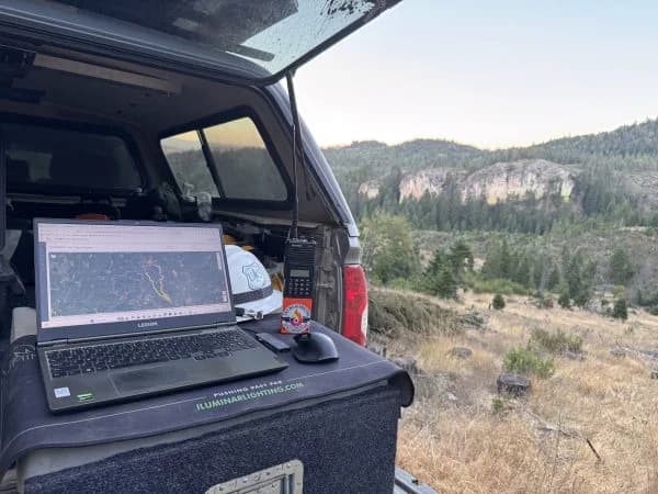
My Lenovo Legion 5 has been my primary development machine for years. I used it to build the Collaborative’s processing pipeline, create agency-specific map templates, and test changes against actual wildfire data before deploying them.
The laptop’s NVIDIA graphics card was particularly important for the work I do with Agisoft Metashape, which stitches individual drone images into larger thermal maps, and ArcGIS Pro, which I use for GIS analysis and map development.
A single flight can produce hundreds of thermal images that must be processed into a usable geographic picture.
For example, during an October flight over West Fork Evans Creek, 195 thermal photographs were processed into a completed map approximately six minutes after being uploaded to our cloud-based stitching system.
Cloud processing now handles much of that work for the Collaborative’s users. My Legion remains essential for processing my own flights, building and testing the software, and handling the large datasets associated with LiDAR mapping.
When the graphics card in my original Legion failed, the difference was immediate. One of my larger ArcGIS Pro projects took approximately two and a half minutes just to open using backup graphics. The cloud system continued serving pilots, but local development and processing slowed considerably.
Lenovo stepped in to provide a replacement Legion Pro 7i, equipped with an Intel Core Ultra 9 processor and NVIDIA GeForce RTX 5070 Ti graphics.
The additional processing capability will help restore our local mapping workflows and support the development of new tools as the Collaborative grows.
“Technology has the greatest value when it helps people solve real problems,” said Mark Hubbard, Lenovo Sr. Product Manager, NA Gaming. “Eli has taken the performance of a Legion laptop and applied it to work that supports firefighters in the field. We’re pleased to provide an upgraded system that will help the UAS Wildland Fire Collaborative continue developing its mapping capabilities and make valuable information more accessible to the agencies responding to wildfires.”
Finding what the fire perimeter missed
One of the clearest examples of why this work matters came during the East Evans Creek Fire in Jackson County, Oregon, in July 2026.
I flew two divisions shortly after midnight on July 21. When I reviewed the thermal data, I could see heat outside the incident’s established daily fire perimeter.
The perimeter showed the reported boundary of the fire. The thermal imagery revealed where heat was actually present.
That distinction matters when crews are working to contain an incident.
East Evans Creek also marked an important milestone for the Collaborative. That same night, a pilot from the Oregon Department of Forestry’s South Cascade District used our system to produce maps under the district’s own template and seal.
It was the first time our automated mapping pipeline delivered products for a pilot outside my company.
Over the following three weeks, the system produced 37 map sets across 15 nights for East Evans Creek. On the busiest single map, we documented 3,327 individual heat sources.
The maps also tracked how deeply crews needed to work inside the fire perimeter during mop-up operations, with the mapped buffer increasing from 100 feet early in the incident to 400 feet as work progressed.
A smaller experience at Woodrat Mountain illustrates the value of identifying even faint heat signatures.
On August 19, a final thermal survey showed almost no remaining heat. The map identified just five possible heat sources.
The following night, I walked the area with the map on my phone. Around 3 a.m., I found glowing embers at the bottom of a stump hole and faint heat deep inside another location identified on the map.
Those signatures could easily have been overlooked.
It’s why our maps include possible heat, even when the thermal signature is uncertain. We leave the final interpretation to the people working on the ground.
Growing from a single laptop to a shared resource
As of October 21, 2026, the Collaborative’s public archive contained 894 files representing 79 nights of delivered maps across 12 wildfires.
Those maps have supported work by pilots from the Oregon Department of Forestry, its South Cascade District, Hummingbird Drones, and my company, Rogue Reconnaissance. Data from ODF’s crewed aircraft has also been processed through the system.
Our partnership with the Oregon Department of Forestry has helped shape how the maps are presented.
For example, drone-observed heat appears in pink, while information from other sources appears in red. That distinction allows someone looking at a map to quickly understand where the information originated.
The agency has also provided a letter of support recognizing the potential value of standardized UAS data processing.
We’re careful about how we measure our impact. We can document the maps delivered, the number of fires supported, and how quickly the system processes information. We don’t yet have reliable data showing how many firefighter hours have been saved or how individual operational decisions have changed.
Those are outcomes we’d like to understand better as the system develops.
For now, the evidence is in the work being delivered and the growing number of pilots using the system.
Preparing for the next fire season
The new Lenovo Legion system will support more than our existing mapping operations.
During the offseason, much of my work shifts toward wildfire mitigation. That includes drone-based LiDAR and multispectral mapping to study vegetation, identify dead or dying trees, and better understand fuel conditions around communities.
These projects produce large point-cloud datasets that require significant processing power.
We’re also continuing to improve our thermal mapping tools. Recent changes allow pilots to view thermal imagery at full resolution, making it easier to distinguish individual hot spots without the smoothing that can obscure important details.
Another priority is making the system easier for additional agencies to adopt. Each organization needs map templates that reflect its own operational requirements and branding. Those templates are built and tested in desktop GIS software before being incorporated into our automated pipeline.
Having a capable local workstation is essential to that development work.
My longer-term goal is straightforward: one free, standardized mapping system available to every wildland fire drone pilot, regardless of agency or location.
A pilot should be able to finish a night flight, upload the data, review the resulting maps, and make them available to incident teams before the morning briefing.
The crews receiving that information shouldn’t have to learn a different mapping format depending on who flew over their division.
There’s still work to do. Expanding the Collaborative will require additional technical expertise and resources to support more pilots. We also want to continue improving the tools that connect aerial observations with the firefighters who rely on them.
The computing technology is helping make that possible.
When I started building this system, I was trying to solve a problem I’d experienced firsthand: finishing a night flight with useful information and knowing how much work remained before anyone else could use it.
Today, that process can take minutes.
With Lenovo’s continued support, we’re building on that progress and working toward a future where the information collected over a wildfire at night is ready for the people walking the fireline at first light.
About the author
Eli Polsky is the founder and executive director of the UAS Wildland Fire Collaborative, a nonprofit organization that provides free drone-based wildfire mapping services to firefighting agencies. A wildland firefighter since 2012, Polsky specializes in unmanned aircraft systems, GIS, and thermal mapping. He also founded Rogue Reconnaissance and works as a drone pilot supporting wildfire operations.